Travel Through Virginia History: The Town of Purcellville

White Palace Diner in Purcellville, VA
White Palace Diner in Purcellville, VA- from the “Small Town Virginia” series

 This article is from a series I wrote for the Mosby Heritage Area Association newsletter during 2010-2012.  Even though I’d lived in Loudoun County for over 10 years, I was amazed at the history that still lived in the County’s small towns and crossroads, especially Purcellville. My sources for the written history were mostly from the chronicles of local historian Eugene Scheel and the folks at the Thomas Balch Library in Leesburg. All photos by J. Riley Stewart.  


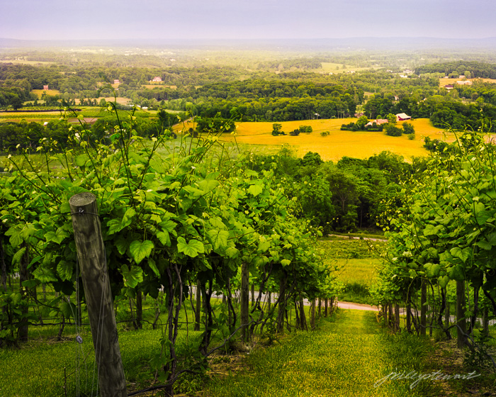
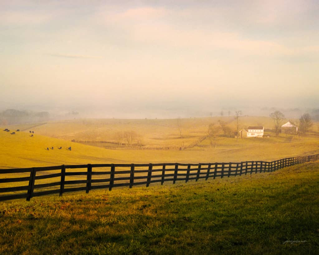
Purcellville is among several Loudoun Valley villages that grew up along the road we now know as US Route 7, but in the distant past was called the “Great Road,” the “Colonial Highway”, and “Leesburg-Snicker’s Gap Turnpike.” Purcellville has an amazing collection of historic buildings that illustrate regional architectural trends from about 1800 to 1957.

In 1764, Quakers James and Rebekah Dillon of Bucks County, Pennsylvania purchased 1,050 acres of John Mead’s original land grant. Most of what is now Purcellville is located on this land. By 1770, a network of crude east-west and north-south roads were in use on the Dillon settlement to get people and goods to Leesburg, Williams Gap on the Blue Ridge, and Hough’s Mill (now Hillsboro).  This early crossroads was to become extremely important to the sustained development of Purcellville.

Purcellville began as an “ordinary” (this is what they used to call a tavern) at the crossroads along the Great Road; a place where folks could get a hot meal, plenty to drink, and share the news of the day. Within a few years of 1800, other businesses here included a general store, a blacksmith, and wheelwright shop.

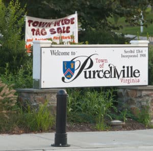
It was the general store owned by Valentine Purcell, however, to which so much of the history of Purcellville is traced.  While some accounts report that Purcell’s store existed as early as 1790 while others say 1822, what is clear is that this little store was the first real village center, served as the post office, an inn, and was the town hall where the vote  occurred on May 23, 1861 to decide secession. The settlement itself was always called “Purcell’s Store” until the establishment of the local Post Office in 1852, when the town’s name officially became Purcellville.

Virginia villages and communities, piedmont, Loudoun Valley photograph, Purcell Store, Purcellville, VA
1822 Purcell House and Store along the “Great Road” (private residence).

Purcellville grew rapidly during the early 1800s up until the Civil War, owing much of this growth to transportation improvements. The first major improvement was the opening of the Leesburg and Snicker’s Gap Turnpike in 1835, which soon became the major east-west route through Loudoun County, including Purcell’s Store.

Purcellville’s first hotel arrived in 1838 and the first recorded stagecoach to the town stopped there in 1841. Samuel Purcell built the Hampton Hotel across the street from Purcell’s store, and it soon became a key stop along the turnpike. The hotel later became a boarding house and provided lodging for visitors to the annual Bush meetings and day-trippers heading out to Bluemont.

Virginia villages photographs, Hampton Hotel photograph, Purcellville VA photograph
The Hampton Hotel, where the first stagecoach to Purcellville stopped in 1841

Purcellville escaped much of the physical tragedy of the Civil War. During the conflict, skirmishing between Union and Confederate troops took place near to but not within the present day boundaries of Purcellville.  Already by 1867 daily train service had resumed to Leesburg from points east, and then one could take a stagecoach to Purcellville or continue west to Winchester or Capon Springs, West Virginia.

The next major transportation improvement was the railroad. In March 1874 the Washington & Ohio Railroad reached Purcellville.  Like so many of the small villages along the Turnpike that were lucky enough to get rail service, the Leesburg Mirror described the situation as a “town . . . springing up as it were overnight.”

Virginia villages photographs, Virginia community photographs, Purcellville, W&OD Railroad photographs, depot photograph
The “new” train depot at Purcellville, built in 1904, replaced the original 1875 depot at the same site. Rail service operated here until 1951.

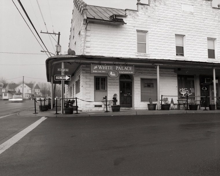
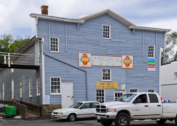
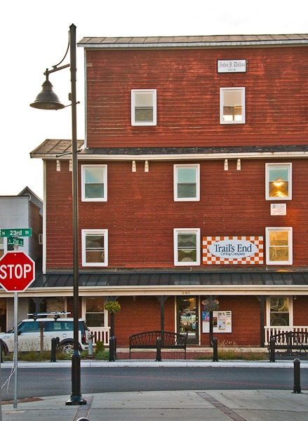
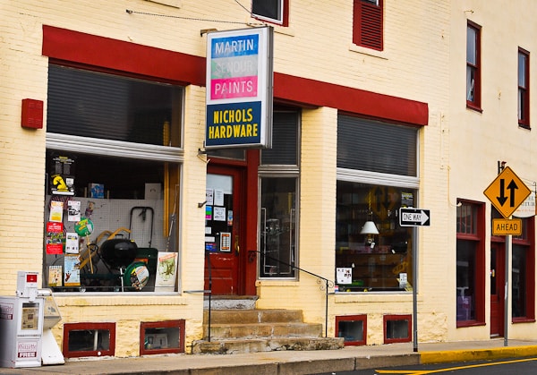
The railroad played an enormous role in the town’s growth. Industrial building began shortly after the rail arrived, and much of it remains today. A glance down Depot Road from Main Street looks like a picture taken from the 1940s.  You see the ornate 1908 Hampton Hall (since 1930 housing the White Palace Restaurant), the 1904 W&OD train depot, the 1905 Smith & Hirst mill, the 1874 John J. Dillon warehouse across the street from the depot, the 1880s livery stable (now part of the Nichol’s Hardware store, and several other turn-of-the-century industrial buildings. The original 1874 Smith and Hirst mill burned in 1882, was rebuilt the next year, burned again in 1904 and was once more rebuilt in 1905. It now operates as Magnolias at the Mill restaurant, where patrons can eat amongst historic mill machinery.

Most of Purcellville’s oldest houses and smaller businesses stand along Main Street (the old turnpike) near the center of town. Examples include the original Purcell’s store (1822), the 1838 Hampton Hotel, the 1840s Asa Moore Janney house, and the 1892  ‘Free Church,’ Purcellville’s first church. Newer buildings include the 1911 St. Peter’s Episcopal Church, the 1915 Purcellville National Bank, many 1920-1930 era Craftsman-style bungalows, and the 1937 public library.

Old Livery Stable, 1880s, Purcellville
Old Livery Stable, Purcellville-Erected in the 1880s, now part of Nichol’s Hardware.
John Dillon Mill Purcellville, VA
John J Dillon Mill (1874)- One of the earliest commercial/industrial structures remaining in Purcellville. By 1905, it housed a milling business and, by the 1930s, a store and farm implements warehouse.
Virginia mill photograph, Hirst and Smith mill photograph, Magnolia's at the Mill restaurant photograph
1905 Hirst and Smith Mill, which cleaned orchard grass to produce seed well beyond WWII.
Purcellville Town Hall
Purcellville Town Hall- Originally the Purcellville Baptist Church, built 1927-28 by Bluemont builders Clarence and Otto Kelly.
Asa Moore Janney House photograph, Purcellville history architectural photograph, antebellum architecture photograph
1840s Asa Moore Janney house, Purcellville, VA
Nichol's Hardware Purcellville, VA-Oldest continuous business in Purcellville
Nichol’s Hardware-Oldest continuous business in Purcellville

Last but not least, one of the oldest buildings in town isn’t in the town center, but instead sits north of town across from Southern States along Hillsboro Road (North 21stStreet). The aging white stucco house on the east side of the road was built in 1795 as the second home of James and Rebekah Dillon, the first settlers of Purcellville.  Almost idyllic sitting there amongst the large trees, the old house, sadly, is boarded up and in much need of help.

1795 James and Rebekah Dillon House, Purcellville, VA
The timeworn stucco house on North 21st Street is probably the oldest standing building in Purcellville, erected in 1795. It was the second home of James and Rebekah Dillon, the first settlers of what is now Purcellville.

The important collection of both pre- and post-Civil War architecture in Purcellville rivals any other town in northern Virginia. It is listed on the National Register of Historic Places and the Virginia Landmarks Registry.

I live near Purcellville and have been there more than a hundred times. Still, I had no idea of the wealth of late 19th Century artifacts there. One reason is the volume of traffic in the town: one gets so busy just driving that it’s easy to miss the treasures. My recommendation is to slow down, walk around the historic district, take in the nice restaurants and shops, and enjoy the ambience for what it’s worth.

_______________

I’m traveling around Virginia visiting its many small towns during quiet times; before the hustle bustle begins, to feel what they might have been like  75, 100 years ago. Follow my progress with Small Town Virginia.

J. Riley Stewart, Leesburg, VA

Travel Through Virginia History: Quaker Land from Philomont to Lincoln, Virginia

Today’s trip takes us to the village of Philomont, the southern-most of the three “Mont Villages” along Snickersville Turnpike, then to Lincoln, where Quakers established the Goose Creek Meeting in 1736 that continues as an active community today.

Philomont

Philomont is a quiet, shady little village at the crossroads of Snickersville Turnpike and Jeb Stuart Road in Loudoun County, Virginia. To the north of Jeb Stuart Road was 434 acres granted to Quaker Joseph Dixon; to the south was the 538-acre 1739 grant to Englishman Lovell Jackson. Absentee Englishmen held the Jackson grant until 1836, when ownership transferred to ‘locals,’ who were predominantly Methodists.  One prominent family on the south side of the road was the Roszels, who made it possible to build the first church in the area, the Mountain Chapel. As early as 1769, an Anglican chapel sat near the Hibbs Bridge on Mountain Road (Snickersville Turnpike). The Southern Methodists assumed control of the chapel in 1890, and because the Milhollen family deeded a half-acre in Philomont to them, they moved their little church, stone by stone, to the new site. It still stands today as a United Methodist Church and carries the name Roszel’s Chapel in honor of the original family who made it possible.

photograph of Roszel's Chapel, Philomont Virginia
Photograph of Roszel’s Chapel in Philomont, Virginia


After the Snickersville Turnpike Company straightened The Great Road (or Colchester Road) in 1818, and where it then crossed with other main roads, the village of Philomont sprang up, grew, and got its first post office in 1831. Three years later the town had six dwellings, one school, seven mercantiles, two saddlers, and probably a blacksmith and a wheelwright shop.

The only remaining store today is the one built in 1913 from concrete blocks made on site. It has an interesting history, having been built for “Pop Milhollen” who had owned the red brick store across the street until it burned down in 1908.  The new store was named Pearson’s General Store and it remained a Milhollen family business until 1964.

Virginia village, photograph, historic architecture, General Store, Philomont, vaOver the years, the Philomont Post Office moved from store to store, but eventually found its permanent home in the old Pearson’s Store, renamed Philo-Mont Gen Store in 1966. It remains the only Loudoun County Post Office to operate from a store, just where it has since 1941.

Lincoln

North of Jeb Stuart Road in Philomont lies Loudoun’s historic Quaker land, all the way to the Potomac River between the Catoctin Mountains and the Blue Ridge.

The period 1730 – 1850 was a period of rapid growth and territorial migration of the Society of Friends, or Quakers, into northern parts of Colonial Virginia. Already settled in Maryland by 1725 (Monacacy Meeting at Buckeystown, MD) and in the Shenandoah Valley by 1730 (Hopewell Meeting near Winchester, VA), Quakers further migrated to areas along the south bank of the Potomac River and its tributaries. By 1735 there were so many more Quakers in Virginia compared to Maryland that the Hopewell Meeting became the business meeting for all Quakers in this area, including the community led by Amos Janney in 1733 to Waterford, VA, named Fairfax Meeting.

Jacob Janney, a relative of Amos, settled on the banks of Goose Creek about eight miles south of Fairfax Meeting as early as 1736. Friends locating there first worshipped in private houses, but moved into a log meetinghouse by 1738. In 1745 Janney sought to establish a new meeting called Goose Creek Meeting, and it was permitted in 1749. Goose Creek Friends bought a 10-acre tract to erect a meetinghouse and schoolhouse, and to establish a burial ground.

Quaker Meetinghouse photograph, Lincoln Virginia,
Old Stone Quaker Meeting House (1765), Lincoln, Virginia

The new 1765 stone meetinghouse became the center of the Goose Creek Meeting, but by 1815 the Meeting had outgrown it. A new brick meetinghouse, a schoolhouse, a stable, and other smaller structures were built between 1815 and 1817. These historic structures and the homes built since make up a beautifully quaint cloister of Virginia history we see as Lincoln today.

Lincoln’s history is remarkable in its strong supportive relationship between its black and white residents, consistent with Quaker dogma. They worked side by side in building and caring for Quaker resources, and both black and white children were taught in the Quaker schools.

Oakdale School Lincoln, VA, photograph, historic architecture
The One-Room Oakdale School operated from 1815 – 1885

Lincoln likely was a significant hub along the Underground Railroad. Quaker and mapmaker Yardley Taylor of Evergreen was the one Loudouner formally accused of aiding slaves while the Underground Railroad was operating, and Quakers in Lincoln and stories of slaves moving northward to crossings on the Potomack River were often linked.

After the Civil War, the village was named Lincoln (after Abraham Lincoln). By then it had its own post office, two stores, an iron foundry, a tanyard, an undertaking business, a milling shop, a tin shop, and a livery stable, among other businesses.

For more images of the area visit our photo gallery by clicking or paste http://www.pbase.com/mosbyheritage/philomont2lincoln in your browser.

Also visit “Small Town Virginia” – a photographic project to capture the quaintness of our Virginian hamlets during the quiet hours.

Copyright 2012, J Riley Stewart

Travel Through Virginia History: From Bluemont to Unison and the Battlefield District

Once among the most densely populated parts of Loudoun County, the many small towns in the Loudoun Valley fell victim in the mid-20th Century  to the population migration towards the big cities. They became the quiet enclaves they are today, still surrounded by beautiful farms and estates that are little changed from the 1860’s.

virginia piedmont landscape photograph
Western Loudoun Valley, where the landscape today is much like was in the 1800s

Bloomfield

The town of Bloomfield was founded in January 1816. It took its name from the fields of wildflowers along the Blue Ridge near the town.  At its peak in the 1830s, Bloomfield had a population of around 60, having “..12 houses, 2 stores, a tan yard, a tailor, a cabinet maker, and a boot and shoe factory.”  The children were schooled in the Old Ebenezer Baptist Church, just up the road from Bloomfield.

virginia piedmont landscape photograph, Virginia Piedmont Loudoun Valley, Bloomfield, historic architecture
The 2 Ebenezer Baptist Churches in Bloomfield, which served both the “Old” and the “New” Baptists in the early 1800s

The Ebenezer Baptist Churches are remarkable architectural examples from the late 18th and early 19th century. The Old Church (the brick structure on the left in the above photograph) may have been built as early as 1769.  The larger New Church (built about 1855) is stone and covered with stucco in the Greek Revival style.

It was to the Old Ebenezer Church where Confederate Colonel John Mosby and his men went to divide the Federal payroll they “captured” during his 1864 Greenback Raid. Mosby’s partisans penetrated Gen. Sheridan’s rear echelon in the Shenandoah Valley, attacked and burned the Union’s payroll train, and carried off  $170,000.

Once back at the Old Ebenezer Church, the Confederates divvied up the money for personal use, but Mosby himself refused his share.

Bloomfield, complete with its view of the flowers, today is a very quiet little place and well off the beaten track. It has about 12 structures, one of which is the 1857 Johnston Chapel, which served as Bloomfield’s “downtown” Methodist Episcopal Church until 1949. It now is serving as a farm structure, sadly. The other landmark is Freeman’s Store, built in 1925.

virginia piedmont landscape photograph, Virginia village, Freeman's, Store, Bloomfield
View of Bloomfield today, showing the 1920s Freeman’s Store and stone houses

Unison

Virginia Piedmont, photograph, history, towns, antebellum, Civil War, Unison, Battle of Unison
This roadside marker announces the historic significance of this small Loudoun Valley village

Traveling east on Bloomfield Road takes you to the quaint village of Unison, established in 1813. The Unison Historic District contains a collection of architectural styles from the early 19thCentury and was the site of the most intense fighting during the 1862 Battle of Unison.

During the 1700s, first the Quakers and then Methodists settled here, worshipping in private homes.  In 1771, the local Quakers bought a 10-acre tract of land about a mile south of the village and four years later established the South Fork Meeting of the Society of Friends. South Fork Meeting was one of the more lax Quaker settlements, frequently being the subject of numerous infractions of the rules of Quaker discipline and morality.  South Fork Meeting was ‘laid down’ in 1889. Methodists built their first chapel here—the Old Bethesda Church–in 1785. The current Unison United Methodist Church replaced it in 1832. It is still in use today, and is the most prominent building in this small village.

Most of the development of Unison occurred after 1802 and up until the Civil War. Its 1830 census recorded 135 residents with 25 houses and several businesses.

Virginia Piedmont, history, towns, antebellum, Civil War, Unison, United Methodist, architecture, preservation
Unison United Methodist Church, built in 1832 to replace the 1785 “Old Bethesda Church”

Battle of Unison

This battle of the American Civil War until recently was known as the “unknown battle.” It was only in 2011 that the Commonwealth recognized the Unison Battlefield as an official state historic district.

The pristine Unison Battlefield Historic District encompasses 8,000 acres in Loudoun and Fauquier counties and constitutes one of the largest historic districts in Loudoun as well as being its first battlefield historic district.

There are few historical markers on the battlefield so common around Virginia, and very little physical evidence that it even occurred. Yet, it was this battle that led President Lincoln to fire General McClellan in 1864 as the Commander of the Union Forces, replacing him with Maj Gen Ambrose Burnside.

In late October 1862, following the Battle of Sharpsburg, President Lincoln noted that McClellan’s 100,000-man Army was actually nearer to the “homeland” of the Confederates than was Lee’s army, situated at the time in the Shenandoah Valley. Knowing that General Lee would be taking his 50,000 man army back toward Richmond, Lincoln ordered Gen McClellan to place his force between Lee’s and Richmond, and potentially end the war.

So it was in early November of that year that McClellan was moving –ever so cautiously as was his manner–southward through the Loudoun Valley to block Lee’s army from reaching Richmond. Lee anticipated the danger, however, and ordered J.E.B. Stuart to take 1000 cavalry and artillery to delay the Union forces to give Lee time to cross the Blue Ridge and advance to Richmond.

virginia piedmont landscape photograph, fine art photography, historic architecture, barn, winter, landscape, Unison, VA
Historic barn along the banks of Dog Run, where the Federal vanguard first encountered Stuart’s intrusion to start of the Battle of Unison

The first clash occurred near Unison along a small stream called Dog Branch. Over the first three days of November, several hundred Union infantry, cavalry, and artillery followed and clashed with Stuart’s greatly outnumbered confederates between Philomont and Upperville, with the heaviest action being at Unison. The town and its surrounding fields were repeatedly bombarded by both Union and Confederate artillery.

virginia piedmont landscape photograph, historic, architecture, towns, Unison, farm
Virginia farmhouse within the Unison battlefield site, in Winter

By the time McClellan was finally ready to move on to Richmond, Lee had escaped the trap. The NY Times reported on 5 November that Stuart “baulked what might have been a splendid success.”

Following the Battle of Unison, the Methodists returned to their Church to find the pews stained with blood and the loft covered in graffiti from the Union soldiers who were treated there. One faded note by Ellsworth Packer, Co H, 21st Connecticut Infantry Regiment says:

“In some lone hour of bliss, When sorrows are forgot, Then cast a happy glance at this, And read forget me not.”

Virginia, towns, piedmont, historic, architecture
Saffel’s Store was once the main mercantile and post office and the last remaining business in Unison.

Unison remained a thriving village and close-knit community until the population migration to the larger cities virtually emptied the small communities of Loudoun Valley. All that remains today of its once vibrant commercial district is the Unison Store, erected in the late 1800s for Henry W. Saffel. Henry ran it until 1937 when he was killed in a robbery at the store. His son Clyde Monroe Saffel continued to run the store until 1961, when his daughter’s family assumed ownership.  They operated it until the late 1980s. Terri Craun Teeter (currently of Bloomfield and great-grandaughter to Henry) remembers “growing up” in the store, getting off the school bus there and staying with her mother until closing at 9 o’clock. The store finally closed its doors in 1997 and currently houses the Unison Preservation Society.

The area between Bluemont to Unison to Philomont is a beautifully bucolic piece of Loudoun Valley that offers a glimpse of what  our Virginia landscape looked like prior to the Civil War. Its villages are small enclaves connected largely by dirt roads that traverse gently rolling hills. Among these hills are many cattle, horse, and sheep pastures, stately stone manors and old barns, small creeks with low-water fords, and abundant vistas.

virginia, piedmont, pastoral, landscape, sheep
Grazing Sheep along Airmont Road
Virginia, Piedmont, Loudoun Valley, Airmont, historic, architecture,
Sunrise at the Bushrod Lynn Farm
Virginia, Piedmont, Loudoun Valley, landscape, pastoral, cattle, water
Pastoral Scene along Newlin Mill Road

To see it for yourself, follow these roads: Foggy Bottom Road from Bluemont, Bloomfield Road to Unison, Unison Road to St. Louis Road then north to Snickersville Pike, Airmont Road north of Bloomfield, and Woodtrail Road to Airmont.

For more images of the area visit our photo gallery by clicking or paste http://www.pbase.com/mosbyheritage/unison your browser.

All images and text copyright 2012, J Riley Stewart

Travel Through Virginia History: Bluemont and the Snicker’s Gap

“Walk Through the Vines” – Valley view in the Bluemont area of northern Loudoun County

The tiny village of Bluemont, Virginia has the distinction of being the highest community in Loudoun County at 680 ft above sea level. It has been known in the past as Snicker’s Gap, “Punkin Town,” and Snickersville. The name Bluemont was selected in 1900 to reflect the cooling nature of this gem in the Blue Ridge; it was an attempt to re-brand the area as a tourist destination.

By 1757, when Loudoun County was established, there was already a “road” through William’s gap–the dip in the Blue Ridge near Bluemont– known as the Indian Thoroughfare. The Thoroughfare  ran “from Willams Cabbin in the Blew Ridge” to the Little River near present day Aldie. The road went through territory that was part of George Carter’s 1731 patent from Lord Fairfax. By 1745 the road was known as “Mountain Road.” At the Gap, however, calling it a road at that time was an exaggeration. Surveyor George Washington in 1748 decided to take Mountain Road during one of his Shenandoah Valley trips and became lost by 20 miles. Thank goodness for us he found his way through.

It was customary in those days to name the gaps through the Blue Ridge after the operator of the ferry across the Shenandoah River below the gap. But so far as anyone knows, there never was a Williams who operated the ferry below Williams Gap. The ferry there was authorized as early as 1748, and by 1760 Edward Snickers was its operator, and remained so for 30 years.

Snickers was a personal acquaintance of George Washington, who traveled the area frequently. Snickers became a wealthy landowner on both sides of Williams Gap, at one time owning about 2700 acres, including 624 acres on the eastern side of the Gap. His influence in the area left its mark, as Williams Gap eventually took his name and became Snickers Gap, and the small village at the foot of the gap (now Bluemont) was christened Snickers’ Gap in 1807 when a post office was established there. In 1826, the General Assembly incorporated the town as Snickersville.

It wasn’t Ed Snickers, however, to whom we attribute the successful settlement of Snickersville. In 1792, William Clayton bought the 624 acres that once belonged to Snickers just below Williams Gap. The 1790 advertisement in the Virginia Gazette described the acreage as a ‘valuable plantation at the foot of the Blue Ridge on the main road from Winchester to Alexandria.”

Clayton’s 1813 will described his vision to establish a town at the crossroads of the Snickers Gap Turnpike Road and the Snickers Gap-Leesburg Road. He bequeathed small ½ – 1 acre lots to his children. Clayton had already sold four lots to persons outside the family. The lots were all arranged tightly around the crossroads, making the founding of a community there nearly inevitable.

Long time town physician Dr. George Plaster wrote in his 1902 A History of Bluemont: “In the early years of the 19th century the village had grown to an active little business place, with tavern, stores, blacksmith, wheelwright and other shops of artisans, such as at that day were needed to supply the wants of a neighborhood”

Amos Clayton’s large native stone house still stands today as Clayton Hall, at the junction of Clayton Hall Road and Snickersville Turnpike. The Snickers Gap Turnpike Company used it for company meetings and events, and Amos raised his family of 12 children there.

As long as the town rested at the important crossroads of commercial travel, Snickersville remained a thriving community. The Civil War had also taken a toll on the Snickersville Turnpike. After the war, only the westernmost piece was in a condition to merit payment for passage. Dr. Plaster described the situation in the 1870s as “disastrous.” “Trade and business were drawn away and the village left stranded in a motionless eddy.”  Further calamity to the commerce of the town arrived during the late 19th Century  when two things happened: first, the Leesburg Road was re-routed around Bluemont taking traffic away from town, and second when the railroad company decided to stop its tracks at Round Hill.

Bluemont would have one more hurrah, however. By 1900, it had rejuvenated itself as a mountain resort town, offering an escape from the harsh summer heat of the Virginia Piedmont and Tidewater regions. Nice accommodations and genuine mountain hospitality led to such popularity in Bluemont that the W&OD Railroad decided after 25 some years to complete the last four miles of track from Round Hill and capitalize on the growing need for rail travel to the mountains during the summer. When the W&OD ceased operations in the 1930s, Bluemont once again became a quiet village off the beaten track–just as it remains today.

The landscape around Bluemont is beautiful at any time of the year. Being predominantly farmland, the area is beautifully pastoral, where you can find many horse and cattle pastures.  Rolling hills that seem to hold the low-hanging clouds forever adds beauty and drama, and diffuse the warm sunlight in ways not common once you get away from the Blue Ridge.

For more images of the Virginia Piedmont visit  J Riley Stewart Fine Art Photography

Please visit my Facebook page:

Copyright J Riley Stewart, 2012

Travel Through History in Virginia

Rural scenic from Loudoun County, VA
Sunrise Along Loyalty Road- This pastoral scene of the Catoctin Valley captures that magical time when the rising sun commands all life to begin the new day.

Introduction.

One of my passions is historic preservation, acts of man that always requires SOMEONE to take an aggressive action and make a compelling argument for saving something of historic significance from destruction, and thereby saves that significant something for the likes of me to enjoy today.

This passion often lifts my heart, and sometimes, actually more often than not, it breaks it.

Over the past year I’ve worked extensively with the Mosby Heritage Area Association (MHAA), a foundation here in northern Virginia dedicated to educating others about the rich history and early cultures of northern Virginia, including Loudoun County. Loudoun County is less than 200 miles away from Jamestown, Virginia, first settled in 1620. Settlers began moving into Loudoun County about 1730. Thus, there’s a lot of historic evidence here to save. Every time I find it still here to admire, my heart is lifted. Sadly, there’s a lot of history that’s been lost forever: …burned…plowed….recycled……destroyed.

Every month I write an article and produce a photographic gallery for readers of the MHAA news letter.  I’m going to duplicate them here to hopefully reach a wider audience for the information. Since I’m potentially reaching an audience that’s not as familiar with Virginia history and geography, I’ll also include maps and other information to help you connect and get more out of the articles.

Here’s what I want to happen:  1)You’ll learn more about the history of colonial America and it many peoples; 2) you’ll learn about the various groups and government organizations that advocate historic preservation across the entire Country–solely for our benefit and that of our children; and 3) you’ll gain an appreciation for the hardships, lifestyles, craftsmanship, and entrepreneurial spirit of early America.

Where it began…

The geographic threads that have always stitched this part of northern Loudoun County together are the Catoctin Mountains, the Catoctin Valley, and the area between Short Hill and the Blue Ridge known as Between the Hills.  Among these physical entities our earliest settlers landed, their families and businesses grew, prospered, and died, and now we, the area’s contemporary inhabitants, are able to enjoy that rich heritage.
American Indian presence in the Catoctin Valley ended with the Treaty of Albany in 1722, and white settlement began shortly thereafter. German “squatters” crossed the Potomac from Maryland and Pennsylvania, clearing and farming land owned by Lord Fairfax. The area surrounding Lovettsville is still known as “the German Settlement.” Quakers began migrating into northern Virginia, first into Frederick County in 1732, then into what is now Loudon County to settle near Waterford, Lincoln, and Taylorstown.
Loudoun County map, showing major geographical entities

Along with German squatters and migrating Quakers, a number of Tidewater Virginia landowners leased large tracts of land from agents of Lord Fairfax and established their own forms of agriculture and human culture. They brought the plantation economy–and tragically the slaves who made it profitable– to northern Virginia and grew tobacco and grain.

So it was that Loudoun County was a cultural “mixing bowl” from its beginning: by 1750 its inhabitants included native Americans, Quakers, Germans, Africans, Dutch, English, French, Irish, Scottish, and Welsh.  This cultural mix led to many diverse architectural styles and a great diversity of religious, political, economic, and social lifestyles.

Taylorstown Historic District

The small hamlet of Taylorstown, Virginia was among the earliest villages in Loudoun to be settled by the Germans and Quakers. Taylorstown has two of the oldest standing houses in Loudoun County, “Hunting Hill” and “Foxton Cottage”, directly across the Catoctin Creek from each other. The historic district itself is listed on both the National Register of Historic Places and the Virginia Landmarks Register.

Taylorstown sits on the banks of the Catoctin Creek about two miles south of the Potomac River. Devout Quaker Richard Brown from Bucks County Pennsylvania was probably its first resident. He arrived in 1730 to find a site for a milling operation.  Finding Catoctin Creek to be the ideal location, he acquired several hundred acres and established a milling operation along its banks “where the water flow was sufficient.”

Between 1734-1737, Brown constructed a small, one-and-one-half-story stone dwelling that sits atop a hill to the north of the present mill. This dwelling, known as Hunting Hill, is thought to be the oldest standing building in Loudoun County.

Essentially unaltered from its original building, Hunting Hill has a German plan consisting of a large hall and two smaller chambers separated from the hall by a board partition. The hall is heated by a large fireplace centered on the west wall.

Hunting Hill, c 1734
Hunting Hill, c 1734, Taylorstown, VA


The village of Taylorstown has always been tightly linked with its old stone mill. It is a real treasure, as the majority of mills in Loudoun County, a county once known for its many mills, have disappeared. And although numerous such milling communities survive across the state, few possess a setting so scenic or a collection of historic sites of such interesting diversity as the tiny hamlet of Taylorstown.In 1784, Richard Brown’s son, Mercer Brown, sold the old log mill and family farm to Thomas Taylor, a wealthy Quaker from Frederick County, Maryland. After establishing himself here, Taylor began selling off half- acre lots near the mill, and the resulting small community came to be called Taylors Town. Taylor’s son Henry built the present stone mill in 1796-1800, making it the oldest of 5 remaining mills in Virginia thought to have been built in the late 1700s.

The Taylorstown Mill was continuously in operation until 1911, when its water wheel was sold to the nearby Oatlands Mill and the mill converted to steam power. In 1932, the steam engines were removed and the Mill became a feed store until bought in the late 1950s and restored. Since the late 1960s, Taylorstown Mill has been a private residence.

By the mid-1800s, the Taylorstown area was one of the most densely populated areas of Loudoun County. The town had a post office, a blacksmith’s shop, 2 mills, a U.S. Government-operated still, general and supply stores, a movie theatre, and a school. In 1850 the mill was one of thirty water-powered mills collectively processing a half-million bushels of wheat in Loudoun County, making Loudoun one of the state’s leading flour producers at that time.

The year 1932 was disastrous for Taylorstown. The school closed, the main stored burned, the post office closed, and the mill stopped operating.  A new store opened in 1938 that can be seen today. It remained the main town store until its owner, Mrs Annie Elizabeth Mann, died in 1976.

The story of Thomas Taylor is an original “American Story.” The family chronicles say that he came to the colonies as an indentured servant in 1743. He was 13 at that time. When he turned 21 he received a land grant from Lord Calvert in Maryland and began acquiring other tracts in the area. He and his wife raised 7 children. The six girls required ‘finishing’ school in Baltimore and the finest in clothing, which Quaker Taylor was able to provide at much expense. But to his son Henry, he left the mill property and 200 acres in 1797. The community prospered under Henry’s management, and in 1833 the first reference to “Taylor Town” was made in a deed of transfer.

Foxton Cottage

Not much is known about Foxton Cottage. The original structure, probably built circa 1800, is thought to be a patent house designed by William Penn as a model “frontier house.’ It was probably first acquired by Philip Souder as part of 126 acres he obtained from Charles Bennet, 3d Earl of Tankerville, who began selling off 100 acre tracts of his massive Catoctin Manor in 1789. The present-day patent house is completely preserved, quaintly situated alongside the west creek bed at the end of a winding lane, and is a private residence.

Foxton Cottage, thought to have been designed by William Penn as a model frontier house

Trouble during the Civil War

For most of the area’s history, the Quakers, Germans, and Tidewater families lived and worked in harmony. But as Virginia entered the mid-1800s and the talk of succession heated up, harmony turn to animosity. For the pacifist Germans and Quakers living in northern Loudoun County, military service during the Civil War was indeed contentious.  Forced to choose, many joined one side or the other. Some joined the independent Loudoun Rangers, 2 Companies organized to “hamper” the Confederates and directed by the Union Army. Those who joined the Loudoun Rangers included many devout Quakers. Charles Means of Waterford, first Commander of the Rangers, was himself a Quaker.  It was the only Union military unit ever established within the Confederacy.

The Confederates also established a battalion here, nicknamed “White’s Comanches” and led by Lt Col Elijah White from Leesburg. Both Means and White recruited from exactly the same areas within Loudoun County, so the same family names were found on the rosters of each. Thus, the relationship between the two units (and between families) was especially antagonistic. Both units were fighting on their home territory, often brother against brother, soldiers from both units courted the same local girls, and they attended the same parties. Every interaction was an opportunity to ‘engage the enemy,’ and each side exploited every opportunity.

The area was subjected to Sheridan’s burning raids in 1864; the result was catastrophic for both Federal and Confederate sympathizers. General Merritt was ordered to “..consume and destroy all forage and subsistence, burn all barns and mills, and their contents, and drive off all stock in the region ..” of Loudoun County. The 5 days of raids resulted in great destruction of property and loss of livelihood. General Merritt’s preliminary report said that “..from 5000-6000 head of cattle, 3000-4000 head of sheep, and 500-700 horses had been driven off, while 1000 head of fatted hogs had been slaughtered.” It listed as burned 230 barns, 8 mills, 1 distillery, 10,000 tons of hay, and 25,000 bushels of grain.

The Catoctin Valley was, and likely remained so for decades following the War, a torn fabric of community.

Today the area surrounding Taylorstown is beautiful open rolling hills, pastures, and abundant streams. Where once many villages stood, there is but little evidence. A once vibrant milling economy never recovered from the Civil War.

Image taken along Featherbed Road on a frosty morning

For more images of the area visit my photo gallery by clicking Here or paste www.pbase.com/mosbyheritage/taylorstown into your browser.

You’re invited to also visit my online image gallery !

 ©J Riley Stewart, 2012, all rights reserved